Barbora Hinnerova
SOLUTIONS
5 MINS READ
Using Data to Make Smarter Real Estate Decisions
Discover how digitized zoning plans and data insights improve real estate decisions—from smarter land selection to better risk assessment.

In the fast-paced world of real estate, making informed decisions is crucial for success. Whether you are a real estate professional or a developer, understanding the potential of a site or land is key to ensuring a profitable investment.
This is where location intelligence comes into play. By utilizing data-driven spatial insights, you can enhance every stage of your real estate investing decisions, from land or site selection and risk assessment to marketing and investment planning.
At CleverMaps, we have extensive experience in analyzing and processing data related to the real estate sector. Our expertise lies in smoothly integrating various datasets, including real estate cadastres, town zoning plans (known as "Územní plán" in the Czech Republic), population data, road networks, points of interest, and utility networks like electricity and sewage.
This comprehensive approach allows us to provide real estate professionals with a powerful tool for effective land and site selection, ultimately facilitating more successful real estate transactions. Let’s dive into the ways to effectively search for land or a site using a modern data-driven approach.
Effective Land and Site Selection for Your Real Estate Investing
To optimize the process of selecting the best site or land for your residential or commercial real estate project or investment, we have developed in the Czech Republic a one-of-a-kind website application. This tool empowers users to find the most suitable sites or lands based on specific criteria in just a few clicks. Here's how our solution works:
Digital Data Integration
We have digitized all town zoning plans across the Czech Republic and connected them with other relevant spatial data such as population density, road networks, points of interest, utility connections, and cadastral data. Our approach can be replicated in other countries, providing you with a tailored solution wherever you are operating.
Efficient Searching in CleverMaps Studio
Our map-based website application allows users to swiftly search for lands and sites of interest by simply setting a few parameters in the user interface. The results are displayed instantly, saving you time and effort.
Powerful Visualization
All potential sites and lands are visualized on an interactive map, enabling you to understand spatial relationships and assess the suitability of different locations with ease.
Informed Decision-Making
With a comprehensive, up-to-date view of all relevant information, you can make decisions that are both informed and efficient, reducing time and costs. The solution also offers the flexibility to export data to other platforms for further analysis.
If you want to learn more about effective land selection in the Czech Republic, visit our Czech website CleverEstate.

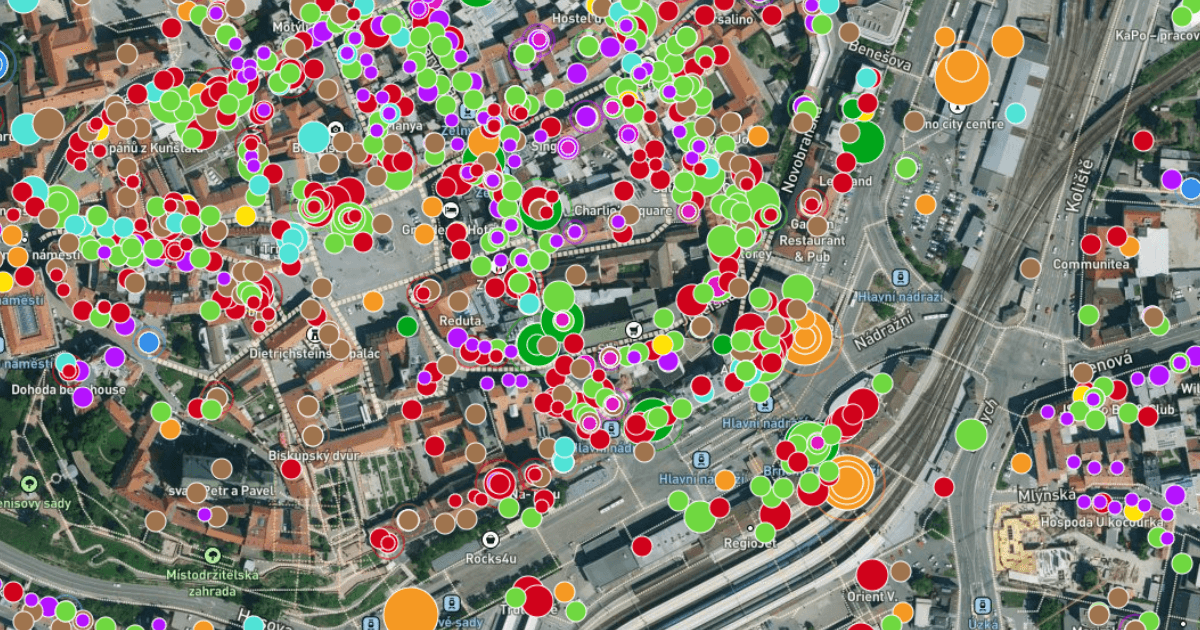
An example of searching for land for real estate in CleverMaps Studio.
Town Zoning Plans: The Foundation of Land and Site Selection
The town zoning plan, or in Czech "Územní plán," is one of the most critical datasets for finding a new site or land for real estate investment. However, in the Czech Republic, this process can be challenging due to the decentralized nature of these plans.
Each town in Czechia hosts its zoning plan on its own website, typically in PDF or image format, with varying legends and visualization standards. That is why we decided to change that at CleverMaps in cooperation with Moře půdy which specializes in the buying and selling of agricultural land through auctions and direct sales across the Czech Republic.
Why Did We Decide to Digitalize Town Zoning Plans?
We faced two major challenges in the Czech Republic:
Inconsistency: Each town's zoning plan has different symbols and formats, making it difficult to interpret and compare plans across regions. Understanding each new plan required learning a new set of standards.
Scarcity of Land: As available sites for new construction become increasingly scarce, it is essential to have comprehensive data to identify suitable locations for development.
To address these challenges, we digitized all town zoning plans into a single, uniform dataset that allows for easy and efficient searching across the whole country.
How Did We Digitize Town Zoning Plans?
Our digitization process for property in the Czech Republic involved:
Creating our own data model, as a uniform standard for zoning plans has only been implemented since 2023.
Evaluating and vectorizing key zones relevant to our objectives.
Assessing the quality of source data.
Converting PDF formats into database-readable data.
Establishing regular updates to ensure accuracy and relevance.


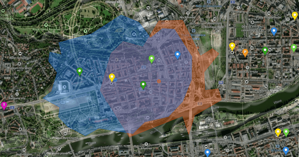
Searching for land in CleverMaps Studio.
Maximizing Real Estate Value Through Digitized Zoning Plans and Spatial Data
Digitized town zoning plans, combined with other spatial data, form an advanced asset that can significantly enhance the value of real estate investments by providing comprehensive data for decision-making. This data helps investors understand the intrinsic worth of properties and the potential financial returns, influenced by factors like location, economy, and local conditions.
We recognize that each country has its own approach to town zoning plans. In this article, we aim to inspire you with our solution, encouraging the adoption of a data-driven approach to real estate in your country as well. If you’d like to learn more about the digitization of town zoning plans (Územní plán) in the Czech Republic, visit our Czech website CleverEstate, or feel free to contact us to arrange a call.